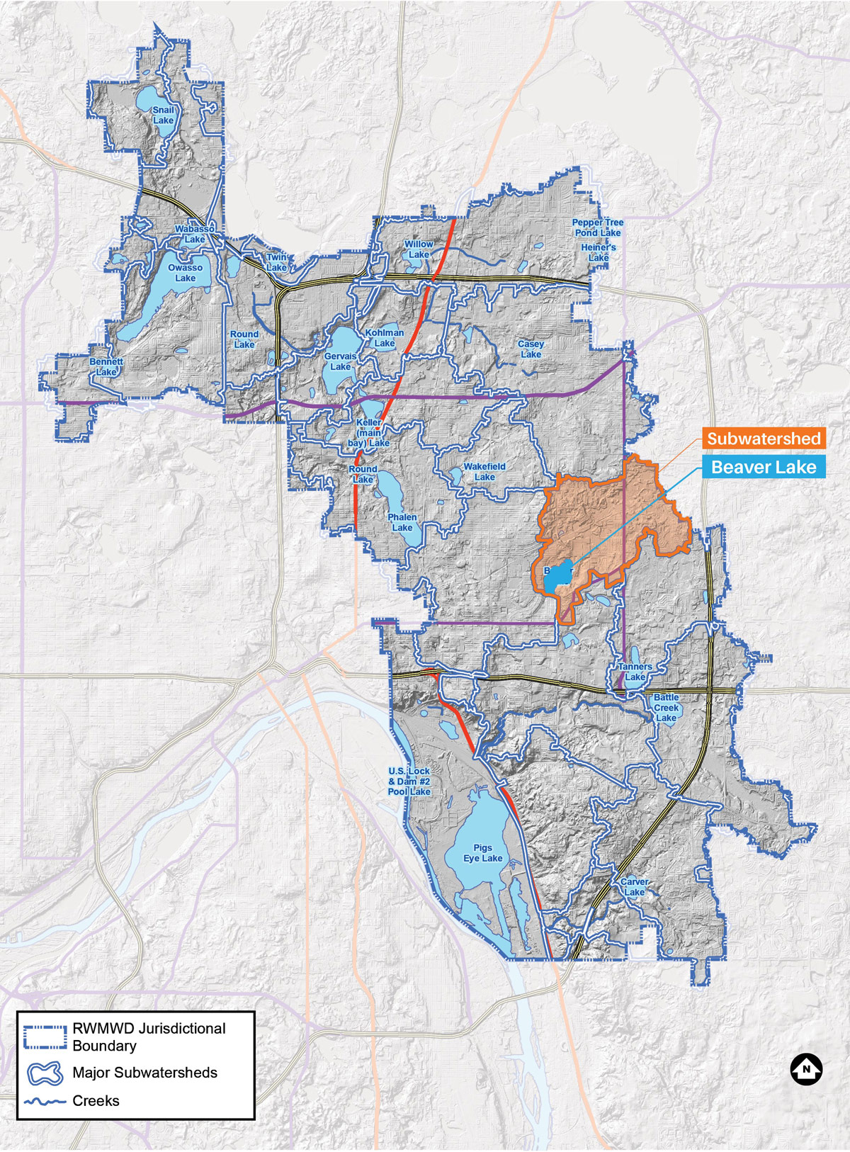
Beaver Lake

A 87-acre lake draining to the Beltline storm sewer and then to the Mississippi River.
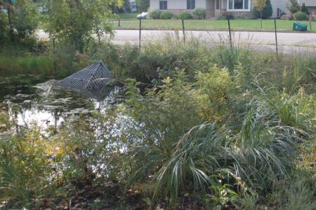
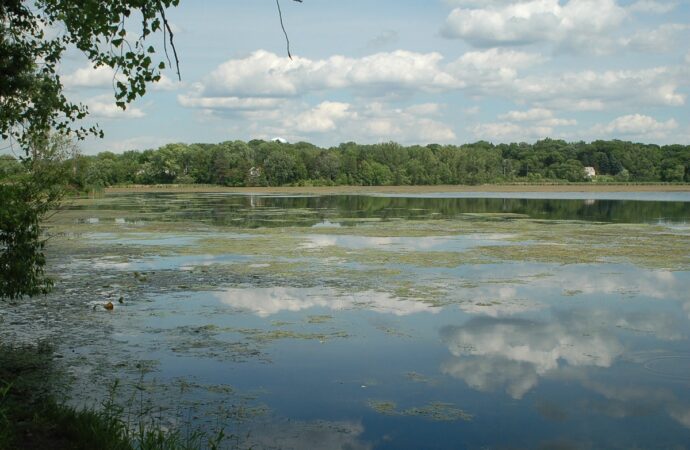
Beaver Lake is primarily used for canoeing, fishing, picnicking, wildlife habitat and aesthetic viewing. A Ramsey County park occupies most of the north and west shoreline. There is no public boat access, although there is a fishing pier on the west shoreline within the county park.
Lake facts
- Tributary area: 1,935 acres
- Downstream waterbody: Beltline
- DNR code: 62‑0016P (click for LakeFinder data)
- Surface area: 87 acres
- Average depth: 4 feet
- Maximum depth: 11 feet
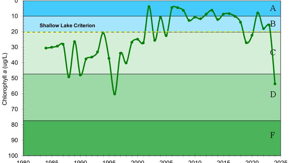
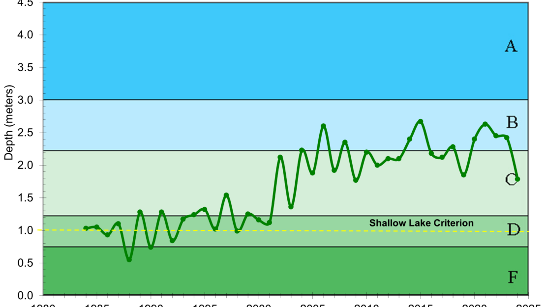
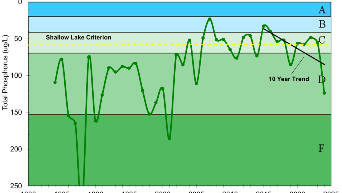
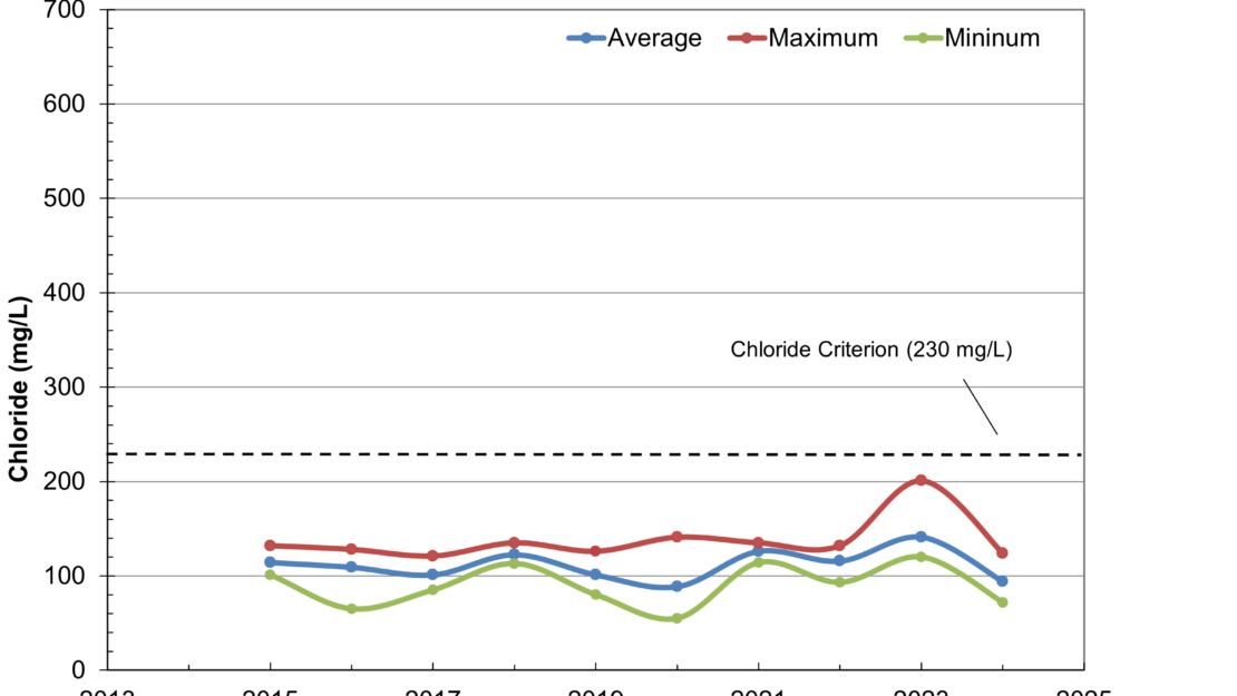
- MPCA designations: Shallow lake; impaired for mercury; at risk for chloride
- Accountable municipalities: Maplewood, St. Paul, Ramsey County, Washington County
- Nutrient water quality classification: At risk