
Construction around Grass Lake marks ongoing efforts to address high water
Roads and trails around Vadnais-Snail Lakes Regional Park in Shoreview have seen construction activity ramp up as projects are underway to optimize drainage of high water in the area.
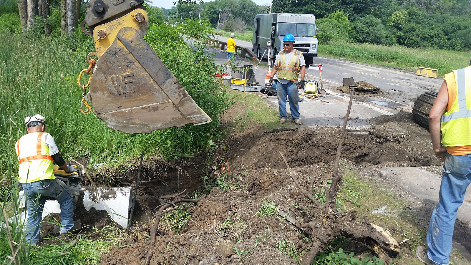
Most notably, a reinforced earthen berm is being constructed along the northeast shoreline of Grass Lake. The project is designed to help contain the lake within its banks during periods of heavy rain. In addition, a culvert was installed beneath Gramsie Road and a new overflow path constructed for Grass Lake in early July, the latest step in a process to manage flood risk for nearby homes and property.
Ongoing study
Over the past two years, the Ramsey-Washington Metro Watershed District has coordinated an in-depth study of the complex hydrology around Grass Lake and Snail Lake, which have experienced persistent high water conditions after several years of high precipitation, including the record rainfalls of 2016.
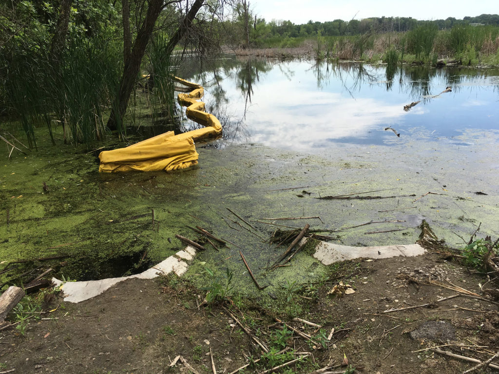
So far, the study has yielded several construction and maintenance projects designed to optimize drainage and make the most of available flood water storage in undeveloped wetlands around Grass Lake. Also being considered are larger, more complex options that could potentially manage area lakes and wetlands at lower water levels.
The Grass Lake and Snail Lake system of ponds, wetlands, parkland and residential neighborhoods includes parts of Shoreview, Roseville and Vadnais Heights. While area homes have not experienced significant flooding, high groundwater and surface water has impacted Ramsey County trails and forced closure of the Snail Lake public beach.
The District is working with county and city partners to deal with high water in this area, but there are no simple solutions. The low-lying system tends to drain slowly as it flows southward to its ultimate outlet, a relatively small 15-inch pipe under Interstate 694. This outlet was designed to restrict flow because of downstream flood concerns, particularly around Owasso Basin (immediately downstream in Little Canada) and Gervais Lake.
Drainage improvement projects
Drawing on expertise from Barr Engineering, we have identified a number of maintenance projects to improve drainage. Work completed so far includes dredging along Grass Lake’s east shoreline, new twin culverts under the county park trail, plus sediment and cattail removal in adjacent wetlands.
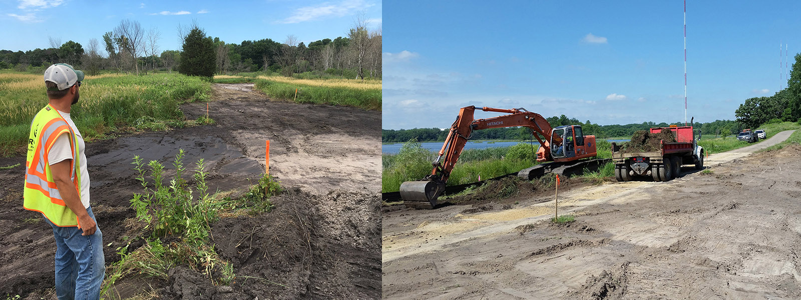
The Grass Lake berm project is well underway with an emergency overflow path and constructed wetlands nearly completed to the south of the berm. According to Water Quality Technician Dave Vlasin, “By creating a new flow path south of the berm, we’re utilizing available flood storage that wasn’t fully being put to use.”
The contractor will next build up the berm itself with compacted layers of clay, sand and topsoil, and then replace trail sections that have been removed to complete the work.
Up next are two more culvert projects at the south end of West Vadnais Lake, which lies at the downstream end of the Grass Lake and Snail Lake system. A new pair of 22-inch by 13-inch culverts under West Vadnais Boulevard should improve drainage southward toward the lake’s outlet. In order to keep the West Vadnais Lake outlet from being clogged with vegetation, a larger opening, riprap and new trash guard will be installed at the intake of the 15-inch pipe running under Interstate 694.
Larger options considered
In addition to the drainage improvement projects underway, the District Board of Managers is also considering the feasibility of larger infrastructure projects in the Grass Lake and Snail Lake area. Two pumping options have been ruled out at this time, each projected to cost at least $2.5 Million. One option would have involved pumping water from Snail Lake (which is landlocked) to Sucker Lake, and the other from West Vadnais Lake to East Vadnais Lake.
We are also studying the subsurface connection between West and East Vadnais lakes, including a proposed geotechnical survey of the berm separating them. This will help determine how the respective water levels and seepage between those two lakes may affect drainage of the Grass Lake and Snail Lake system.
In the coming months, we will continue to gather data, implement projects and evaluate options to address high water in this and other flood-prone areas of the watershed district.
Questions or comments? Join the conversation on our Facebook page, or drop us an email.